|
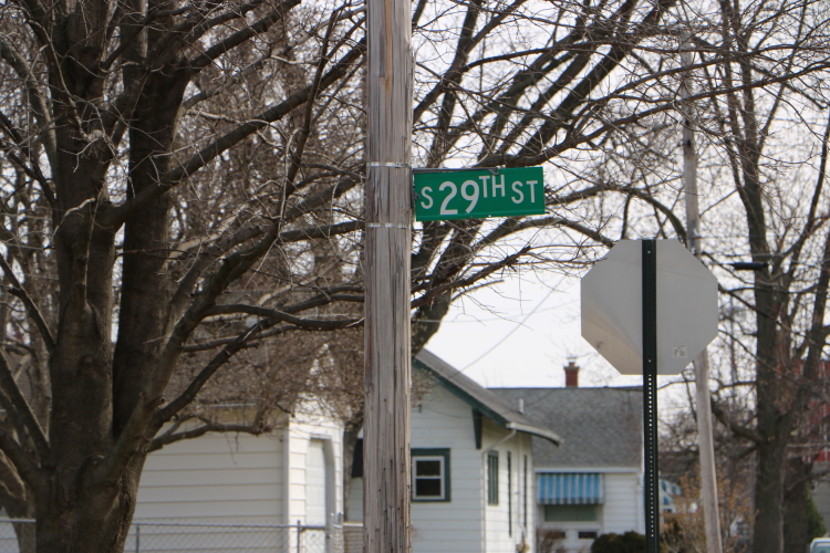
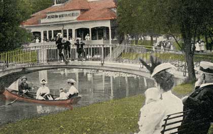
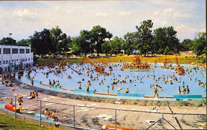
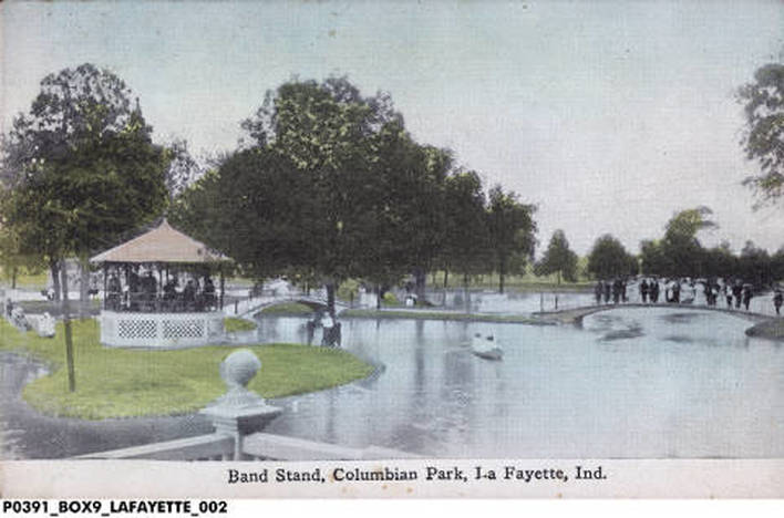
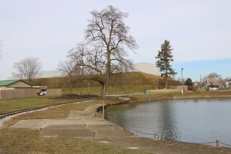
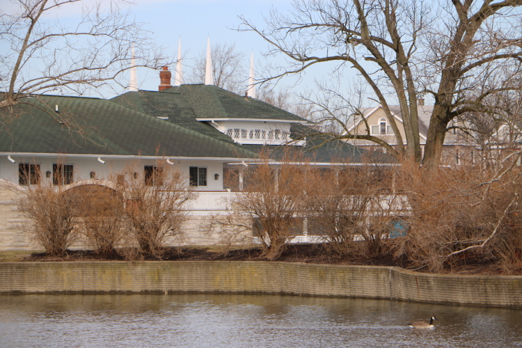
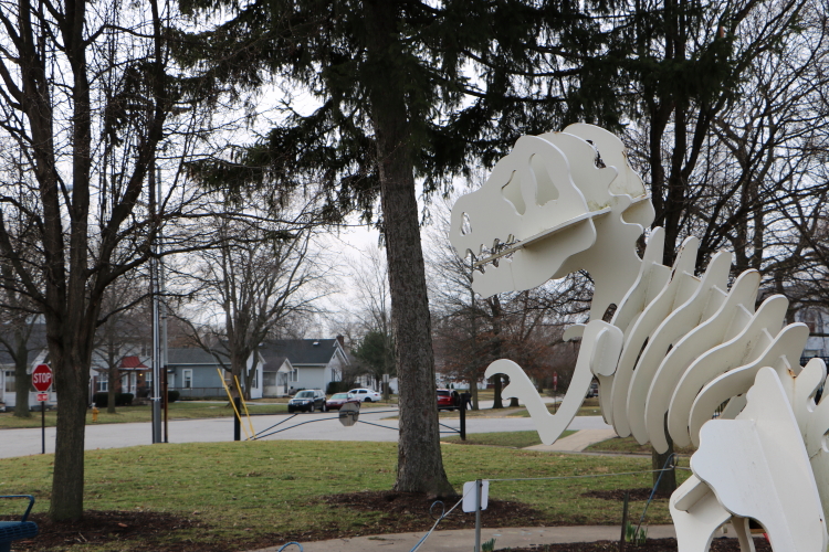
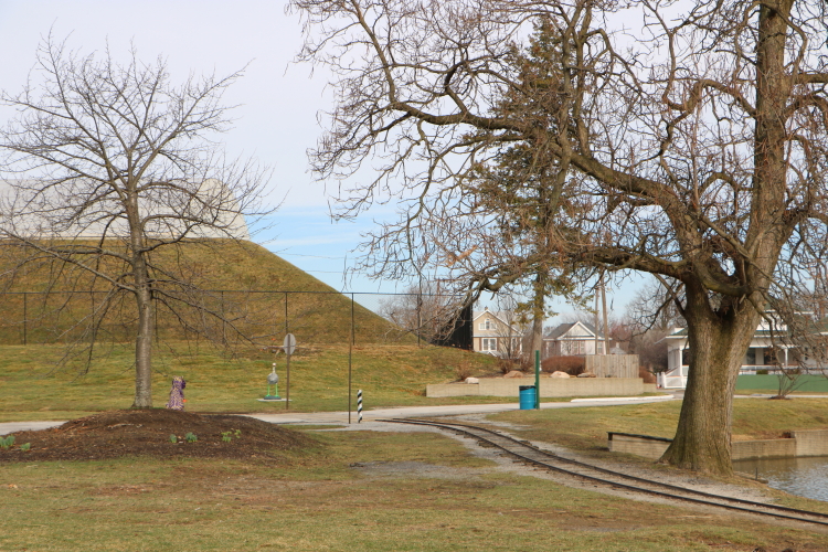
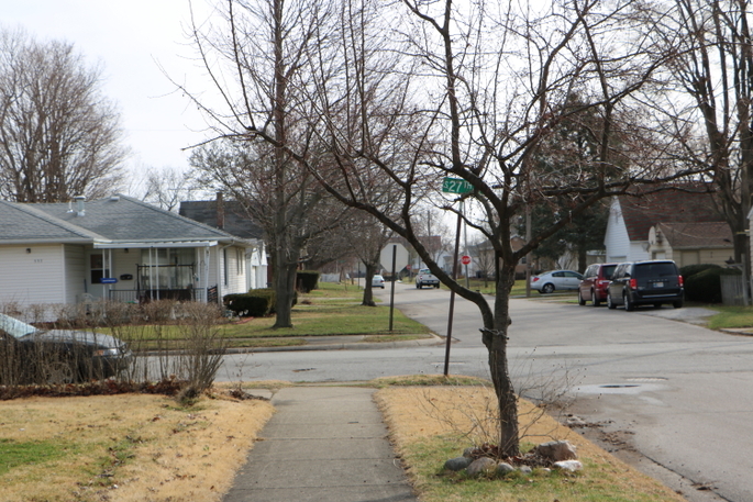
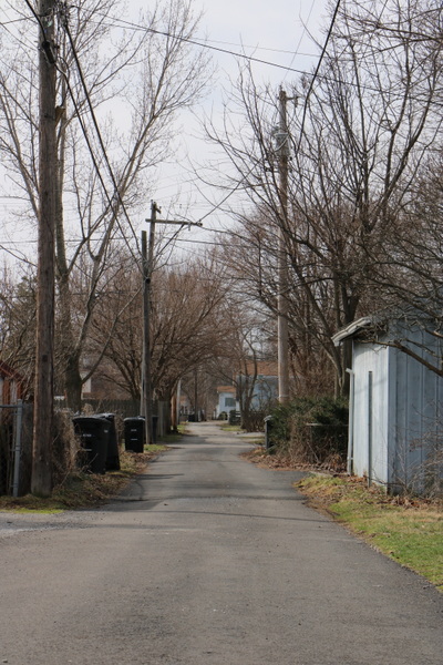
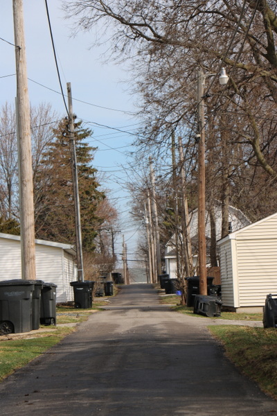
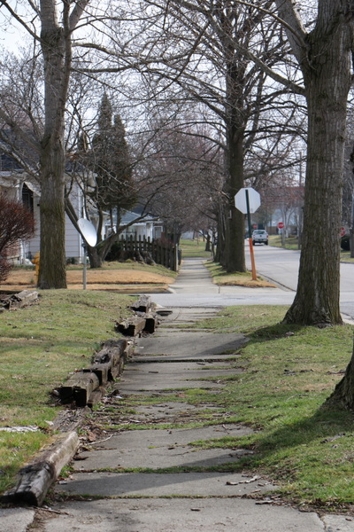
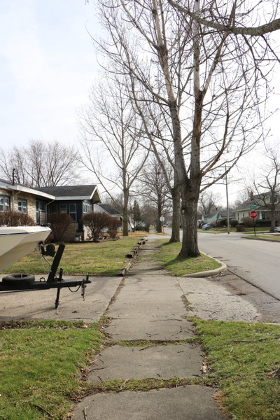
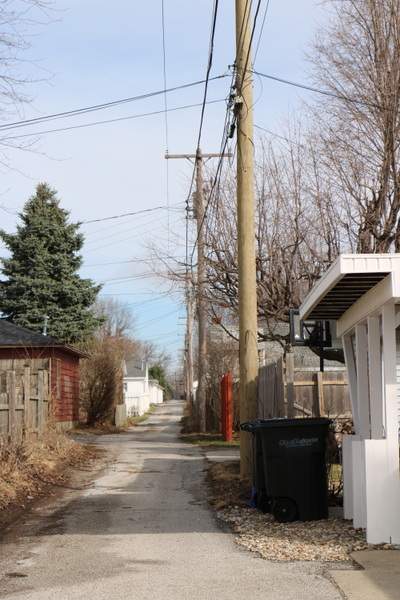
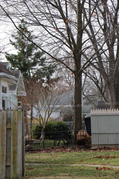
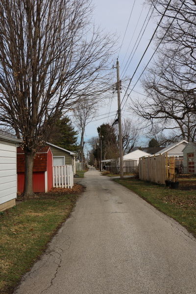
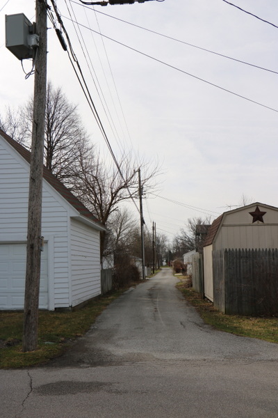
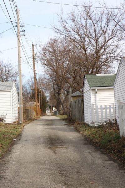
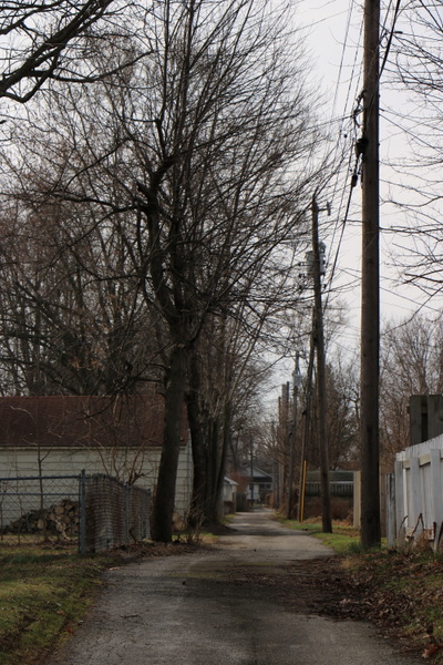
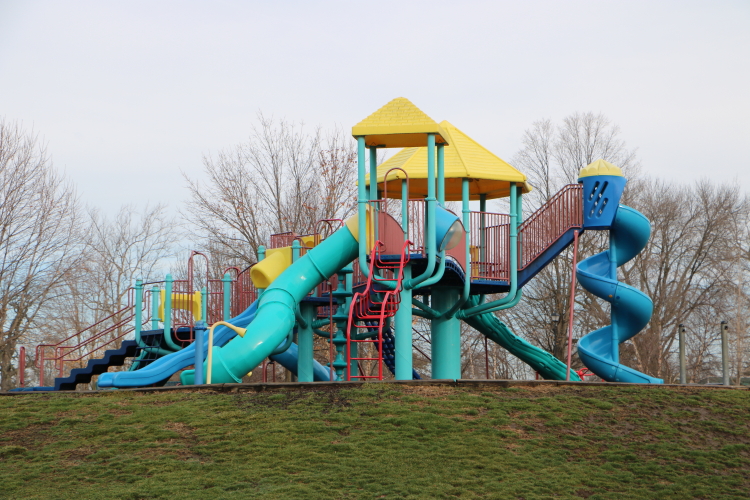
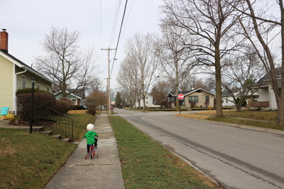
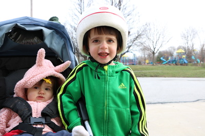
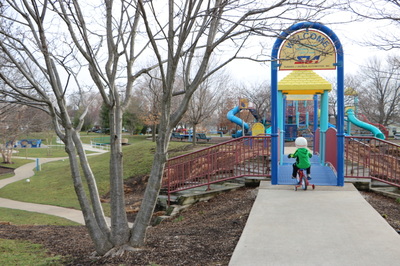
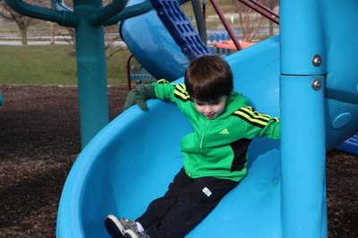
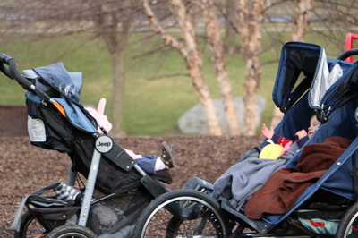
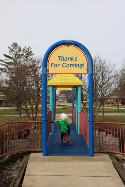
Columbian Park and Neighborhood: March 11, 2016 Today I took a walk around our neighborhood and Columbian Park with the kids. I wanted to take some pictures and explore the natural and human-built overlays of the park and get to know our neighborhood in a different way, so when a friend called to meet up at the park for a walk since the weather was supposed to be nice, I jumped on board. We left the house about 8:30 am and walked four blocks east to the park, along Wallace St. The weather was much cooler than anticipated, though the sun was shining. I pushed the stroller and Jonah rode his “new old-fashioned bike,” a tiny bicycle with training wheels that Marc found a couple of summers ago on the side of the road in Norwalk. It was spray painted an orange-ish yellow (wheels and all) and has since been repainted red, white and blue for last summer’s Fourth of July parade at Redbrook. This was one of the shorter trips to the park – Jonah rode quickly and efficiently (no stops to pick up sticks or pauses to take breaks because he “ran out of biking power”). Once at the park, we rode around the outside of the zoo, around the playground equipment (with several stops to play), and along the pond to the train station, before crossing the street and riding down Park Ave. to my parents’ house. All in all, we were gone about an hour and a half. Preparing for the tripLast night, I spent some time looking up the history of Columbian Park. Several of our neighbors are long-time residents of the Columbian Park Neighborhood and have told us stories of how the park used to be and of the changes in the neighborhood. The couple across the street told us about hearing the tigers roaring at dinnertime when their kids were growing up. Our next door neighbor has talked about the rise in crime in the area due to people moving down from Chicago. We’ve heard about the monkey island which is now the big playground and the old swimming pool. I always enjoy hearing these stories, for the park and zoo as it is now seem to me like they always have been. That is the nature, I suppose, of understanding our own experiences. I found that the reservoir on the far side of the park from our house was started in the 1870s (much earlier than I would have expected and just after the founding of Purdue University) with the dirt for the banks provided when workers excavated the lagoon, which is a “G” shape in honor of Dr. Elias Glick, mayor of Lafayette at the time. In “Past and Present of Tippecanoe County, Indiana” edited by General R. P. DeHart in 1909, we find an account of the Columbian Park pumping station. Lafayette has plenty of water; water for her numerous public institutions; water for the many drinking fountains for man and beast; water for the swimming pool at the beautiful park; water for private and public use everywhere. The great Columbian Park reservoir holds four million two hundred thousand gallons, which is used as a surplus. The general daily water consumed is pumped direct from these tubular wells, which afford the most perfect water for all purposes known to the world today. While many other larger cities are drinking and cooking with water that has been taken from the slums and filth spots and then by a questionable process "filtered," as is the case in St. Louis and Omaha, from the dirty, poison waters of the Missouri, the populace here are using the pure water that comes from a clean gravel bed uncontaminated by any surface matter. Coming from the Lake Erie lakeshore, I do not give much thought to fresh water, or consider Lafayette as a water town. Nor have I given much thought to the Columbian Park Reservoir, as there is no great expanse of park (not playground) surrounding an open reservoir, like at the Norwalk Reservoir. DeHart goes on to write about the history of Columbian Park: Every city should have its numerous parks; some places have a greater need of them than others. Lafayette is situated within one vast park region, through which the Wabash valley courses. The old Indian trail, near the present Soldiers' Home, is accessible for one popular place of outing from this city; the Tippecanoe battle ground is another point of interest much visited. The city had, however, owned about fifteen acres of land to the east of the main platting, and about 1876 had converted it into a park. But little was accomplished in the way of improving it, save to keep the grass cut in the summer months and to provide some few rude swings and a temporary frame building that took the place of a better pavilion. It was considered such sacred(?) ground that signboards adorned its surface, "Keep off the grass," at almost every possible point one might chance to enter the grounds. When the water works were put in and a reservoir made, the overflow was allowed to form into a pool in the location of the present artificial lakes that adorn the spot. It was, in reality, of but little use to the populace of the city as a public park. But with later enactments a levy of three cents was made for the improvement of the place, to which was added about twenty five acres more, making about forty acres in all. The last tract and the commencement of improvements was in 1891, when Adams Earl was park commissioner, and at the suggestion of his daughter, Mrs. Charles B. Stuart, the park was named "Columbian," as it was being started during the year of the great Columbian exposition at Chicago. The first year or two the improvements were very slight, if indeed any, but as taxes were paid in, the spot began to grow in beauty as well as utility. The keep off the grass boards were taken down and people were admitted to roam at will and enjoy themselves unmolested. It has now come to be one of the most delightful parks in Indiana, and is annually being improved at an average of a three cent levy of taxes. Here one finds boating, many a shady nook, islands, suspension bridges, water lilies, and a sparkling pool teeming with tens of thousands of the fishes that are kept for the interest of the frequenters of the park, but not to be caught. The artificial lakes are fed from the city water works and cost the city about one thousand seven hundred dollars per annum. Winding paths and trails and neat, safe swings of all descriptions, including merry go rounds for small children are to be seen in many parts of the park. There is also a large boat house and spacious pavilion, where seats are provided; also booths for refreshments. The swimming pool was the first of the real improvements in this park, and has come to be a very well patronized place for both sexes. The most of the improvements have been made since 1906. During the last year or two the zoo feature of Columbian Park has been greatly added to, and a great interest taken by the citizens of Lafayette and they have made numerous and very valuable donations of animals to this department, which bespeaks for one of the pleasant spots - a real interesting resort - in the near future. Already many excursions have come in from surrounding towns and cities to enjoy a delightful day in the shady nooks and beside the pure waters of the bathing pool and fish ponds of this already magnificent park. Ladies' day in the free swimming pool is being generally observed by the ladies to the end that hundreds of girls and young women have become expert swimmers, thus being further able to protect life in case of an accident on larger water courses - lakes, rivers and ocean. The Columbian Park Zoo, eluded to in this passage, was founded in 1908. The main animal house was constructed in 1928, at which point, an elephant was purchased form the Hagenbeck-Wallace Circus in Peru, IN from funds raised by Lafayette and West Lafayette school children. In the 1950s, a chimpanzee named Buddy came to Columbian Park Zoo and was often found driving the train through Columbian Park. Today, there are no elephants at the zoo. However, there is a farm area, prairie dog town, butterfly garden, and wallaby walkabout, all sponsored by area businesses. In the park, there is no bathing pool or boat house, but there is an extensive series of playgrounds, each designed for different ages of children, including a handicap accessible playground area (a vast difference from the tall, metal corkscrew slide just like the ones my parents remember using as kids that is now a sculpture at the front of the park). Landscape overlaysDisclaimer: I have not studied much geology, so any notes about natural landforms are strictly observed and surmised or pulled from geological studies found online. Columbian Park and the surrounding neighborhood lies at the top of the hill leading down to the Wabash River Valley. It is flat land, as is most of the land beyond the river valley. The Wabash River forms the master valley of the state of Indiana, and a recessional moraine. The Wabash River carried relatively clear water from glacial Lake Maumee, an ice-dammed lake stretching east from Fort Wayne, and was short-lived. These waters cut downward, thus causing the broad and deeply entrenched valley beneath the level till plain through which it flows. (From “The Department of Conservation: State of Indiana” By W. N. Logan, E. R. Cumings, C. A. Malott, S. S. Visher, W. M. Tucker, and J. R. Reeves, 1922). The core of the neighborhood is Columbian Park, whose landforms were created with the digging of the “G” shaped lagoon and construction of the reservoir on the west end of the park. The park sits between two major roads: South Street (Route 26) and Main Street, which angles southeast from downtown Lafayette and intersects the parallel road, Kossuth Street, to South Street. The neighborhoods on either side of the park lie in grids: to the east, a clear north-south-east-west grid and to the west, a patch work of angled and square grids to fit between South and Main. Looking at a preferred land use map from a neighborhood forum, the bulk of our side of the park is comprised of single occupancy homes, while the east side is composed of multi-family units. Along Park Avenue (which creates the east border of the park) and South Street, there are larger homes – some craftsman style and some former farm houses. In the interior of the eastside neighborhood are mostly single story homes built primarily in the 1920s. In the 1800s, Lafayette was a shipping center on the Wabash River. In the 1840s, the Wabash and Erie Canal stimulated trade and affirmed Lafayette’s regional prominence, which continued in the 1850s with the arrival of the Monon Railroad. Most of the general histories of Lafayette available online jumped from its settlement as a trade center to today’s economy, which is centered around the academic and industrial activities of Purdue University and a number of private industry and commerce such as Alcoa, Catepillar, Wabash National, Subaru of Indiana Automotive, Tate and Lyle and others. The dual major economic factors have created pretty clear division between sides of the river; West Lafayette is considered to be the wealthy, educated, and dare I say liberal side of the city, while the east side is lower income and conservative. This of course is a generalization. It is possible though to surmise the neighborhoods built for factory workers and those built for the executives and academics as you drive through greater Lafayette. Columbian Park Neighborhood is solidly blue-collar; I attended my first actual Labor Day (hosted by unions) at Columbian Park the first year after we moved. What about the 1920s, when our house was built? What was valued in our neighborhood? The zoo and park underwent a major remodeling and vision plan in the early 2000s, indicating a renewed value of recreational outdoor spaces. Although, like Theodore Rosak's (Where the Wasteland Ends: Politics and Transcendence in Postindustrial Society, 1974) Disneyland-esque Old Faithful, it is a man-made place. While certainly other parks are carefully crafted to provide a particular experience, a visual rhetoric created by the development of trails, outlooks and docks, fenced boundaries, landscaping and grounds maintenance (or lack thereof) and signage, there is no mistaking Columbian Park for anything other than man-made from the play equipment to the parking and streets which create its boundaries to the landscape and man-made lagoon and elevations. As opposed to local parks such as the Celery Bog preserve that appears to be a more “natural” space, but is in its own right designed for a particular usage and not left to its own devices or for visitors to experience unique and infinite explorations. Around the park, there is evidence of its usage in the early 20th century: the cement boat dock next to the train track; the historic boat house now used primarily as an event venue; and the landforms separating the playground areas (the large hill which use to house Monkey Island for example). No longer is there swimming or boating the in the lagoon; today you’ll find people fishing, wires tangled in the shrubbery surrounding the shore. In the summer, locales flock to Tropicanoe Cove, the brightly colored slides rising above the rooftops. The pumping station still provides water to the city, but its presence is not so significant but to block the view of the houses to the east of the park. As I walked back from the park, without children, I paid particular attention to the alleyways, which form the veins of the neighborhood, housing the power lines, in some cases garbage cans and garages and in others, a buffer between backyards. Young families and long-term residents and graduate students make up the residents of the blocks surrounding our house. The neighborhood ends at Earl Street, which is zoned commercial, and you’ll find many small businesses including auto shops, landscaping, two car dealerships and one of the Alcoa factories. It is not new commercialism; the box stores, groceries, mall, and chain stores and restaurants are further east, beyond Sagamore Parkway (the partial “ring road” which borders Lafayette and swings northwest across the Wabash into the north end of West Lafayette); relatively new builds as I recently talked to a woman that lived on the farm growing up which is now Walmart. From our house, looking down Wallace Street, we can see an orange four-story office building. The neighborhood is relatively insulated between major throughways, which are lined with rental properties and businesses. Aesthetic and emotional connectionConsidering further my place in this history and geology of the neighborhood, I find myself drawn to the concentric circles of belonging - city, neighborhood, block, house - that are measured in part by the layout of the city streets. I have recently worked on paintings that deal with grids overlaid with the “abstract impressionist” style of painting that I typically utilize in landscape painting (bringing together the interest of the impressionists in color and light relationship with the abstract expressionists interest in spontaneity, improvisation, and dynamic, energetic gesture). I suppose that this new interest in mapping is an attempt to explore my aesthetic relationship to place. I did not always live in town; I grew up on a cul-de-sac with seven homes that was surrounded on one side by field, two by forest, and the other by the homes lining the state road. Now that I live in a city, the layout of streets and identifying with a particular part of the city has become important as I try to narrow my sense of belonging to something more intimate and less general.
Even more so, place has changed with our use. We move at a different pace and navigate the terrain depending on whether we have a stroller, bike, or are on foot. As we walk with the kids to the park, we count the streets, identifying them by the quality of the sidewalks (the bumpy sidewalk on the north side of the block between 26th and Park necessitates a crossing over to the other side a block before, when there is a ramp rather than a curb) and the busyness of the traffic. When I think about Columbian Park, I can feel the sun shining on my back and the gentle breeze created by a swing passing back and forth. Or the slight burn of my calves as I scurry up the hill to the big playground, slipping on the mud halfway up. The kids, it seems, are my emotional tie to place these days.
2 Comments
Tom Cornell
3/23/2016 10:06:21 am
Even Theodore Roszak, in his brief sketch "Disneyland Is Better," missed the full drama of Old Faithful and the other distinctive surface displays at Yellowstone. In particular, we now know that the park sits atop the caldera of a supervolcano--which when it erupts creates ashbeds that dwarf in their extent the one created by Mount St. Helens in 1980.
Reply
Leave a Reply. |
Ruth M. SmithCommunity arts educator and researcher. Drinking coffee. Home educating. Making art. Listening intentionally. Categories
All
Archives
February 2022
|





 RSS Feed
